Bay-Walton Sector Plan
NOTE: The information shown, attached or contained herein is believed to be accurate but is not warranted or guaranteed
nor are there any representations made with respect to such information. Sources are cited where applicable.
Click on images for large view
nor are there any representations made with respect to such information. Sources are cited where applicable.
Click on images for large view
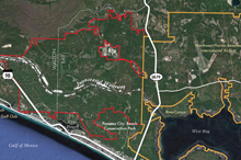 |
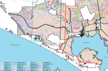
Aerial Map Identifies the approved West Bay Sector Plan boundary and the expansion area included in the proposed Bay-Walton Sector Plan |
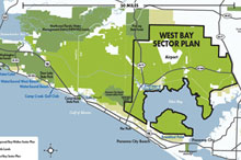 |
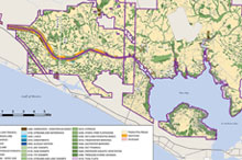
General Location Identifies the approved West Bay Sector Plan boundary and proposed Bay-Walton Sector Plan boundary |
|
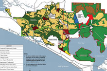 |
Long Term Master Plan Development framework of proposed land uses to be adopted in future land-use maps |
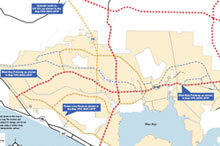 |
Conceptual Primary Roadway Network Possible transportation network to support the Long Term Master Plan |
|
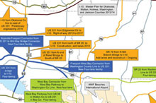 |
Planned Transportation Projects Planned transportation projects in the region |
 |
Florida Land Use, Cover and Forms Classification System Identifies existing ecology of the Long Term Master Plan |
|
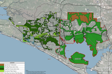 |
Conservation Areas of Regional Significance Conservation and preservation lands in Long Term Master Plan |
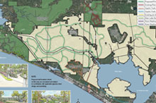 |
Conceptual Trails Network Over 100 miles of public trails are proposed in the Long Term Master Plan to support a healthy lifestyle |
|
 |
Natural Resources Conservation Service Soil Existing soil types in the Long Term Master Plan |
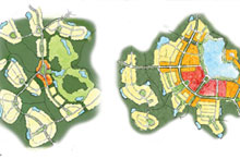 |
Land Use Framework Graphic Illustration Example of possible layout for a Village Center and a Town Center |